
Description
02
Intro
Pure trail fun through dense forests, medium length and medium difficulty.
Description
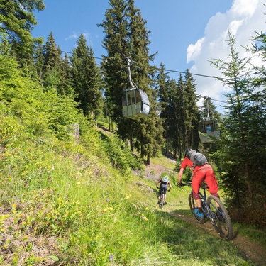
Pure trail fun through dense woodland. Medium length and medium difficulty. Trail tolerance!
Please look out for hikers and cycle with consideration. The start point for the trail is easily accessible from the Dias Alpe (at the Diasbahn cable car mountain station – bikes can be taken on the cable car – or from the Sunny Mountain adventure park) which is best accessed via route 740 (Kleine Dias-Runde, page 80). After a short flat section along a forest path heading west, you will see the trail access point on the left. It is signposted with a large panel between two trees. The trail then weaves its way through the dense forest along beautiful woodland trails with only individual trees and after approx. 700 m crosses a forest road. In the lower section, the forest becomes less dense and the houses at the top of the district of Egg can be reached via the open meadows. From here, the ski descent takes you on down to a forest trail which then leads back to the centre of Kappl.
Arrival
The autoroute (A12 (westbound) or A14 (eastbound)) leads you to the Arlbergschnellstraße (S 16). At the exit for Pians, turn onto the Paznauntalstraße (B 188) and follow its course into the Paznaun.
Parking
Parking area Bergbahnen Kappl
Public transport
With the railway station in Landeck, the Paznaun is optimally connected to the Austrian train network. From Landeck-Zams station, only a short bus ride separates you from the Paznaun. Every half hour, line bus 260 runs from there through the valley. Bus stop: Bergbahn Kappl


