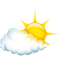
Ischgl

Wetter

Subtitle

Weather today

Temperature
-1 °C / 3 °C
Sunshine hours
0 h
weather.overview.weather-icon-31
Weather morning
Temperature
-1 °C
Rain probability
50 %
Wind direction
S
Wind force
7 km/h
Snow fall border
1000 m
weather.overview.weather-icon-31
Weather afternoon
Temperature
3 °C
Rain probability
50 %
Wind direction
S
Wind force
10 km/h
Snow fall border
800 m
weather.overview.weather-icon-5
Saturday, 15.03.2025
Temperature
-1 °C / 7 °C
Rain probability
25 %
Wind direction
S
Wind force
22 km/h
Snow fall border
1350 m
weather.overview.weather-icon-5
Sunday, 16.03.2025
Temperature
0 °C / 6 °C
Rain probability
30 %
Wind direction
S
Wind force
12 km/h
Snow fall border
1100 m
weather.overview.weather-icon-4
Monday, 17.03.2025
Temperature
-1 °C / 4 °C
Rain probability
15 %
Wind direction
O
Wind force
25 km/h
Snow fall border
1100 m
Weather icon
Tuesday, 18.03.2025
Temperature
-3 °C / 6 °C
Rain probability
0 %
Wind direction
O
Wind force
20 km/h
Snow fall border
1500 m
Weather icon
Wednesday, 19.03.2025
Temperature
-3 °C / 10 °C
Rain probability
0 %
weather.overview.weather-icon-4
Thursday, 20.03.2025
Temperature
-2 °C / 11 °C
weather.overview.weather-icon-5
Friday, 21.03.2025
Temperature
-2 °C / 13 °C
Ischgl

WINTERSPORT

Aktiv
With prevailing low-pressure influence, an air mass boundary is shifting over our region. However, it seems that this boundary will not advance much to the east in the upcoming days, so the flow over the Alps will remain unchanged, directed southward. As a result, the influence of the disturbance will continue to be weakened, and in many places, no significant precipitation will occur. The colder air from the northwest is also only slowly making its way to us. Thus, the overall weather situation will remain a borderline case until the weekend, "neither fish nor fowl." Clouds will mostly dominate the sky. The sun will struggle but still get its chance. Some precipitation, mostly in the form of showers, can occur nonetheless. The snow line will range between 800m and 1700m above sea level. In summary, the weather will resemble typical April weather, and small deviations in the models can have a significant impact. Relief will come only in the new week, when high pressure is expected to become more pronounced.
Ischgl

AKTUELLE WETTERWERTE

Subtitle
Name Altitude Temperature Wind force Webcam
1.180 m 0 °C -
Alblittkopf
Open webcam
2.700 m -8 °C 10 km/h
Diasbahn Bergstation
Open webcam
1.830 m -2 °C 3 km/h

Lorem ipsum dolor sit amet, consetetur sadipscing elitr, sed diam nonumy eirmod tempor invidunt ut labore et dolore magna aliquyam erat, sed diam voluptua. At vero eos et accusam et justo duo dolores et ea rebum. Stet clita kasd gubergren, iam voluptua. At vero eos et accusam et justo duo dolores et ea rebum.

Avalanche warning

1 Low

1 Low
The avalanche warning level refers to the Kappl ski area
divider divider
Test
01
Ischgl

WINTERSPORT

Aktiv
divider divider
Card Teaser Slider
02
Take part and win!

Take part in our survey and with a little luck win a holiday in Austria!